Each month a new map is presented to the Commission to help explain important trends in the Bay Area, across the nation and around the world. These custom-crafted maps are prepared by MTC’s Data & Visualization team.
Each month a new map is presented to the Commission to help explain important trends in the Bay Area, across the nation and around the world. These custom-crafted maps are prepared by MTC’s Data & Visualization team.

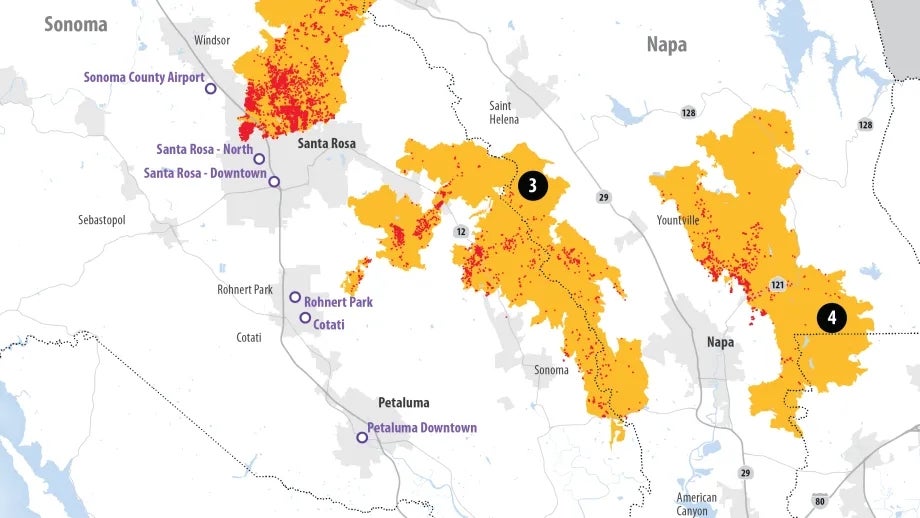
On Sunday October 8th, the first of four devastating wildfires ignited in Napa County near tiny Tubbs Lane just north of Calistoga fueled by parched grass and tinder-dry trees. That same evening, dry, hurricane speed winds swept through the area with gusts over 80 miles per hour at times. Within the first five hours of ignition, the Tubbs fire would be just one of four blazes burning across the Northern Bay area. In total, the North Bay wildfires claimed the lives of 43 people, burning over 161,000 acres across Sonoma and Napa Counties. Some 8,200 structures were either damaged or completely destroyed in the North Bay, the majority of which were located within Sonoma County. Santa Rosa lost about 3,110 structures to the Tubbs Fire. The map in Attachment 2 charts the damage from these fires in graphic form.