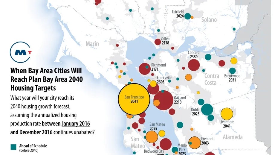
Each month a new map is presented to the Commission to help explain important trends in the Bay Area, across the nation and around the world. These custom-crafted maps are prepared by MTC’s Data & Visualization team.
Each month a new map is presented to the Commission to help explain important trends in the Bay Area, across the nation and around the world. These custom-crafted maps are prepared by MTC’s Data & Visualization team.

On May 1, the California Department of Finance (DOF) released population estimates updated through the end of year 2016, which include detailed data on housing production for the San Francisco Bay Area. While a single year is just one data point and may not necessarily be indicative of long-term trends, this dataset is still useful to understand how the robust regional economy is affecting housing production trends in recent months. The June 2017 map of the month highlights how 2016 housing production compares to the annualized housing forecast from the Draft Plan Bay Area 2040 by identifying how many years it will take cities, at the current rate, to reach the year 2040 forecast.While some cities are on pace or even ahead of schedule to meet the forecast, numerous jurisdictions are way behind – many by centuries.