San Francisco-Oakland Bay Bridge
The San Francisco-Oakland Bay Bridge is the region's workhorse bridge, carrying more than a third of the traffic of all of the state-owned bridges combined. It is also a jewel along the San Francisco waterfront.
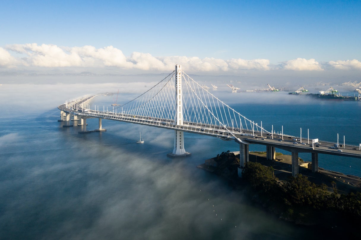
The San Francisco-Oakland Bay Bridge is made up of two bridge segments: a skyway structure/single anchored suspension bridge between Oakland and Yerba Buena Island, and a suspension span from the island to San Francisco. Connecting the two is the largest diameter bore tunnel in the world.
The design of the new East Span — which opened in September 2013 — features a single-tower, self-anchored suspension bridge for the segment of the bridge that crosses the shipping channel, and a skyway structure over the shallower waters close to the Oakland shore.
Seismic retrofit of the West Span of the San Francisco-Oakland Bay Bridge was completed in 2004. The original East Span was damaged in the 1989 Loma Prieta earthquake and subsequently repaired. The replacement East Span opened on September 2, 2013.

How many bikes and pedestrians have used the San Francisco-Oakland Bay Bridge path since November 2016? What times of day do most bikes and pedestrians travel the path?


The Bay Lights 360 art installation – made of 50,000 LEDs and designed by artist Leo Villareal – began nightly illumination of the Bay Bridge on March 20, 2026.

Bridge Facts At-A-Glance
| Location: | Interstate 80, between San Francisco and Alameda counties |
|---|---|
| Structure: | Suspension, tunnel, skyway |
| Length: | 8.4 miles (including approaches and toll plaza) |
| Vertical Clearance: | 220 feet |
| Channel Span: | 1,400 feet |
| Opened: |
|
| Cost: |
|
| Auto Toll: | $8.50 |
| Carpools: | $4.25 |
| Collection: | One way, westbound, in Oakland |
| Traffic Lanes: | Five lanes in each direction |
| FY 2022-23 Total Toll-Paid Vehicles: | 42,753,377 |
| FY 2022-23 Total Tolls Collected: | $274,029,625 |
| Bridge Path Counter Data: | Access bicycle and pedestrian counter data |
See vehicle traffic and public transit ridership numbers from 2019 to the present.