Home Home
MTC is the transportation planning, financing and coordinating agency for the nine-county San Francisco Bay Area.
twitter linkedin facebook instagram youtube
Home
  • About MTC
    • What Is MTC?
      • MTC History
      • Equity Platform
    • Contact MTC
      • Executive Leadership & Senior Staff
      • Complete MTC Staff Directory
    • Commissioners
      • Full Commissioner Roster
    • Committees
      • Interagency Committees
      • Policy Advisory Council
      • Standing Committees
    • Authorities
      • Bay Area Headquarters Authority
      • Bay Area Housing Finance Authority
      • Bay Area Infrastructure Financing Authority
      • Bay Area Toll Authority
      • Service Authority for Freeways and Expressways
    • Public Participation
      • Get Involved
      • Accessibility
      • Language Assistance
      • Request a Public Record
      • Public Participation Plan
      • Title VI: Civil Rights Act
      • Youth Initiatives
    • Administrative Requirements
      • Indirect Cost Requirements
      • Enterprise Systems Catalog
      • Overall Work Program
    • Blue Ribbon Transit Recovery Task Force

      Learn about the Bay Area Transit Transformation Action Plan

      Learn how.
      Friendly bus driver waving
  • Planning
    • Long-Range Planning
      • Countywide Transportation Plans
      • Plan Bay Area 2050
      • Plan Bay Area 2040
    • Housing
      • Welfare Tax Exemption Preservation Program
      • Public Land Reuse
      • Transforming Malls & Office Parks
      • The Committee to House the Bay Area - CASA
    • Land Use
      • Priority Conservation Areas
      • Priority Development Areas
      • Priority Production Areas
      • Priority Sites
      • Transit-Oriented Communities Policy
    • Resilience
      • Sea Level Rise Framework
      • State Route 37
    • Transportation
      • Access, Equity & Mobility
      • Bicycle, Pedestrian & Micromobility
      • Complete Streets
      • Driving: Congestion & Environment
      • Federal Performance Targets
      • Mobility Hubs
      • Public Transit
      • Regional Transportation Studies
      • SF Bay Area Goods Movement Plan
      • Transportation Electrification
    • Plan Bay Area 2050

      The Bay Area’s long-range plan for transportation, housing, the economy and the environment

      Learn more.
      2050 blue and white logo
  • Operations
    • Programs & Projects
      • Bridges
      • Emergency Management
      • Forward Commute Initiatives
      • Freeways
      • Intelligent Transportation Systems
      • Streets, Roads & Arterials
      • Transit Hubs
    • Regional Trails & Parks
      • San Francisco Bay Trail
      • SF Bay Water Trail
      • Judge John Sutter Regional Shoreline / Gateway Park
    • Traveler Services
      • 511
      • Bay Wheels Bike Share Program
      • Carpool & Vanpool
      • Clipper®
      • Commuter Benefits Program
      • Bay Area Express Lanes
      • FasTrak®
      • Freeway Service Patrol
    • The Bay Trail

      Hikers, joggers, bicyclists, skaters and wheelchair enjoy more than 350 miles of trails that circle the bay

      Get on the trail.
      A Bay Trail sign at Sears Point.
  • Funding
    • Investment Strategies & Commitments
      • Fix It First
      • Transit for the Future
      • Housing Solutions
      • Climate Protection
    • Funding Opportunities
      • Bipartisan Infrastructure Law (BIL) Competitive Grants
      • Housing Incentive Pool Grants
      • Priority Conservation Area Grants
      • Priority Development Area Grants
      • Priority Production Area Grants
      • Transit Core Capacity Challenge Grants
    • Federal Funding
      • Federal Highway Administration Grants
      • Federal Transit Administration Grants
      • Project Delivery
    • State Funding
      • Cap & Trade Funding
      • Sales Tax & Gas Tax Funding
      • State Transportation Improvement Program
    • Regional Funding
      • Regional Measure 3
      • Regional Measure 2
      • Regional Measure 1
      • TDA & STA
    • Fund Management System
    • Transportation Improvement Program
      • 2023 TIP
      • Draft 2023 TIP
      • 2021 TIP
      • Draft 2021 TIP
      • 2019 TIP
      • Draft 2019 TIP
      • 2017 TIP
      • Draft 2017 TIP
    • Funding Opportunities

      See current Calls for Projects

      Get the details.
      Cup of change with a plant growing
  • Advocacy
    • Federal Advocacy
      • Bipartisan Infrastructure Law (BIL)
      • Capital Investment Grant Program
      • Surface Transportation Law
    • State Advocacy
      • Housing Advocacy
      • Transportation Advocacy
    • Regional Leadership
    • Covid-19 Relief Funding

      MTC has helped bring over $4 billion to Bay Area transit agencies

      Learn more.
      a friendly bus driver wearing a mask.

Secondary Nav

  • Meetings & Events
  • News & Media
  • Tools & Resources
  • Jobs & Contracts

You are here

  1. Home
  2. Operations
  3. Regional Trails & Parks
  4. San Francisco Bay Trail
  5. Map by Numbers

Map by Numbers

A person walking their dog on a serene path in Briones Hills, with mountains and a lake in the distance.
Credit
Ben Botkin

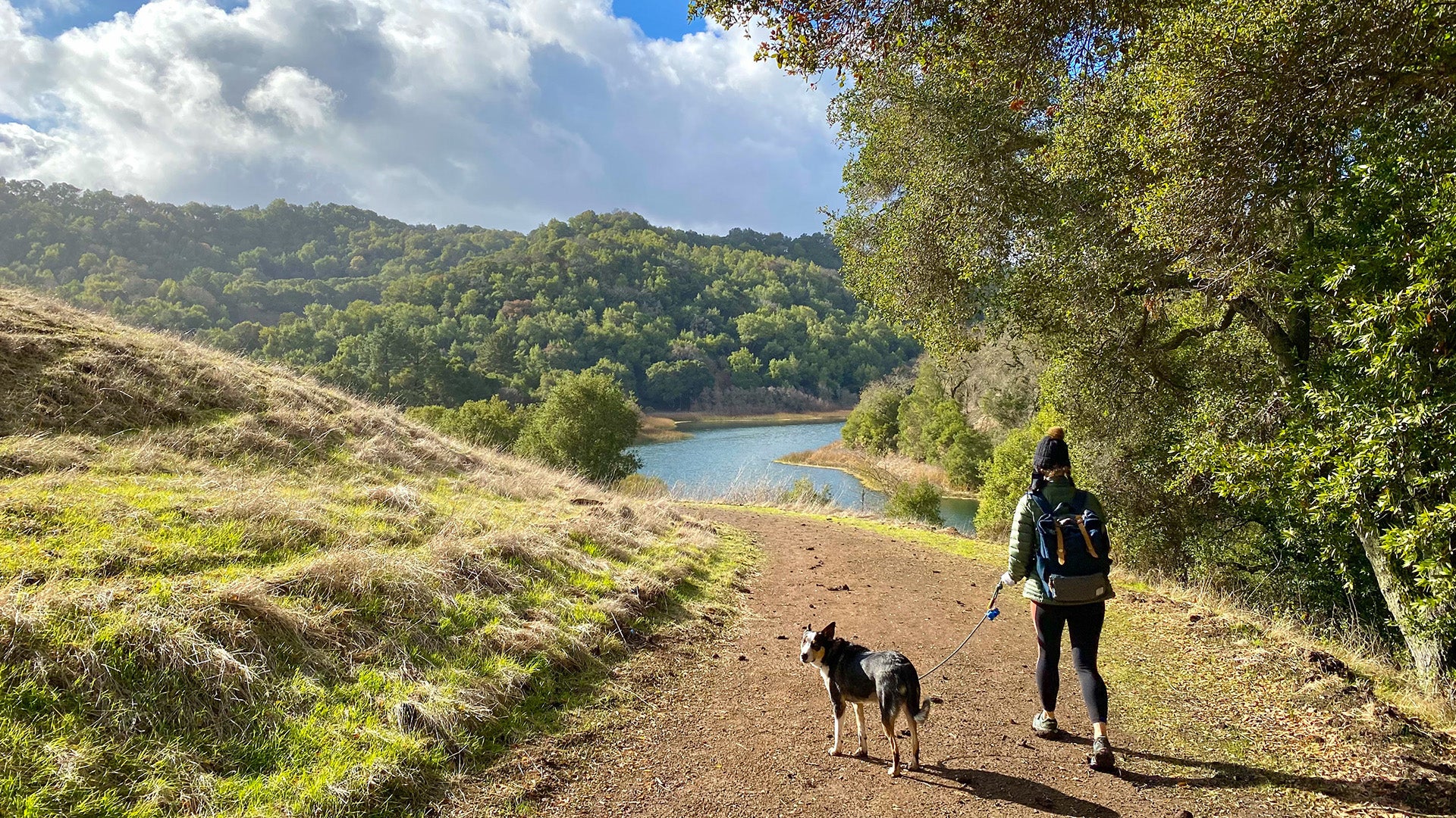
We’ll get you there, and highlight special points of interest along the way. Use these maps to get out and on the trail.

San Francisco Northern Waterfront

Map 1

San Francisco Southern Waterfront

Map 2

Brisbane Lagoon to Bayside Park

Map 3

Burlingame to Redwood Shores

Map 4

Redwood Shores to Ravenswood Slough

Map 5

Ravenswood Slough to Alviso

Map 6

Alviso to Newark

Map 7

Newark to San Leandro

Map 8

San Leandro to Alameda

Map 9

Alameda & Oakland

Map 10

San Francisco-Oakland Bay Bridge

Map 11


Oakland to Alabany

Map 12

Albany to Richmond

Map 13

Point San Pablo Peninsula to Point Pinole Regional Shoreline

Map 14

Point Wilson to Carquinez Bridge

Map 15

Carquinez Strait

Map 16

Benicia State Recreation Area to White Slough Path

Map 17

Northern Vallejo to Napa

Map 18

Hudeman Slough to Black Point

Map 19

Petaluma River to McInnis Park

Map 20

Northern San Rafael Shoreline

Map 21

Central San Rafael to Corte Madera

Map 22

Richmond-San Rafael Bridge

Map 23

Corte Madera, Tiburon & Strawberry

Map 24

Strawberry Drive to Golden Gate Bridge

Map 25

Related News

August 31, 2022
Bay Trail Focus of Bay Day 2022, Event Kicks Off Friday
February 8, 2022
Winter Birding Opportunities on the Bay Trail
December 20, 2021
Bay Trail Website Moves to MTC
May 3, 2021
Bay Trail/Vine Trail Lands $410k Grant for Vallejo Bike Lane
Bay Trail Map Cards

This deck of Bay Trail map cards will help you plot your next outdoor adventure!

See store details.
Bay Trail Logo
Bay Trail Closures

Please visit 511.org or your local city/county website to check for the latest information on temporary trail closures.

See construction alerts.

Operations

  • Programs & Projects
    • Bridges
      • Antioch Bridge
      • Benicia-Martinez Bridge
      • Carquinez Bridge
      • Dumbarton Bridge
      • Richmond-San Rafael Bridge
        • Richmond-San Rafael Bridge Path
        • Richmond-San Rafael Bridge Access Improvements
        • FAQ's
      • San Francisco-Oakland Bay Bridge
        • Bay Bridge East Span Path
      • San Mateo-Hayward Bridge
      • Historic Traffic & Revenues
      • Open Road Tolling
    • Emergency Management
      • Regional Transportation Emergency Management Plan
      • Multi-Jurisdictional Hazard Mitigation Plan
    • Forward Commute Initiatives
      • Bay Bridge Forward
      • Dumbarton Forward
      • Napa Valley Forward
      • Richmond-San Rafael Forward
    • Freeways
      • I-880 Corridor Management
      • Incident Management
      • Managed Lanes Implementation Plan
      • Adaptive Ramp Metering
      • Transportation Management Center
    • Intelligent Transportation Systems
      • Connected & Automated Vehicles
        • IDEA SAV
      • ITS Architecture
      • Regional Communications Network
    • Streets, Roads & Arterials
      • Arterial Operations
      • Innovative Deployments to Enhance Arterials
      • Program for Arterial System Synchronization
      • Pavement Conditions Index
      • Roundabouts
      • Technology Transfer Program
    • Transit Hubs
      • Hub Signage Program
      • Salesforce Transbay Transit Center
  • Regional Trails & Parks
    • San Francisco Bay Trail
      • Explore the Trail
        • Walking
        • Bicycling
        • Urban
        • Remote
        • Birding
        • Dogs
        • Picnicking
        • Learning
        • Fishing
        • Bay Area History
        • Water Trail
        • Bridges on the Bay Trail
        • Beaches
        • Art
        • Parks
      • Bay Trail Navigational Map
      • Map by Numbers
        • Map 1 — San Francisco Northern Waterfront
        • Map 2 — San Francisco Southern Waterfront
        • Map 3 — Brisbane Lagoon to Bayside Park
        • Map 4 — Burlingame to Redwood Shores
        • Map 5 — Redwood Shores to Ravenswood Slough
        • Map 6 — Ravenswood Slough to Alviso
        • Map 7 — Alviso to Newark
        • Map 8 — Newark to San Leandro
        • Map 9 — San Leandro to Alameda
        • Map 10 — Alameda & Oakland
        • Map 11 — San Francisco-Oakland Bay Bridge
        • Map 12 — Oakland to Albany
        • Map 13 — Albany to Richmond
        • Map 14 — Point San Pablo Peninsula to Point Pinole Regional Shoreline
        • Map 15 — Point Wilson to Carquinez Bridge
        • Map 16 — Carquinez Strait
        • Map 17 — Benicia State Recreation Area to White Slough Path
        • Map 18 — Northern Vallejo to Napa
        • Map 19 — Hudeman Slough to Black Point
        • Map 20 — Petaluma River to McInnis Park
        • Map 21 — Northern San Rafael Shoreline
        • Map 22 — Central San Rafael to Corte Madera
        • Map 23 — Richmond-San Rafael Bridge
        • Map 24 — Corte Madera, Tiburon & Strawberry
        • Map 25 — Strawberry Drive to Golden Gate Bridge
      • FAQs
      • About the Bay Trail
      • Bay Trail Gap Closure Implementation Plan
      • Bay Trail Map Cards
    • SF Bay Water Trail
    • Judge John Sutter Regional Shoreline / Gateway Park
  • Traveler Services
    • 511
    • Bay Wheels Bike Share Program
    • Carpool & Vanpool
    • Clipper®
    • Commuter Benefits Program
      • MTC SHIFT
    • Bay Area Express Lanes
    • FasTrak®
    • Freeway Service Patrol

Stay connected with MTC

Sign up to get our latest news.

MTC Logo
twitter linkedin facebook instagram youtube

Bay Area Metro Center
375 Beale Street, Suite 800
San Francisco, CA 94105-2066

Main Phone Number: (415) 778-6700
Public Information Line: (415) 778-6757
Main Fax Number: (415) 536-9800

info@bayareametro.gov

Main menu

  • About MTC
  • Planning
  • Operations
  • Funding
  • Advocacy

Secondary Nav

  • Meetings & Events
  • News & Media
  • Tools & Resources
  • Jobs & Contracts

MTC is committed to operating its programs and services in accordance with federal, state and local civil rights laws and regulations. The following MTC programs are designed to ensure compliance:

Accessibility

Non-Discrimination

Public Participation Plan

Limited English Proficiency Plan

  • Site Map
  • Privacy Policy
  • Terms of Use
  • Legal Notices
Copyright © 2023 Metropolitan Transportation Commission. All rights reserved.